
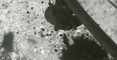
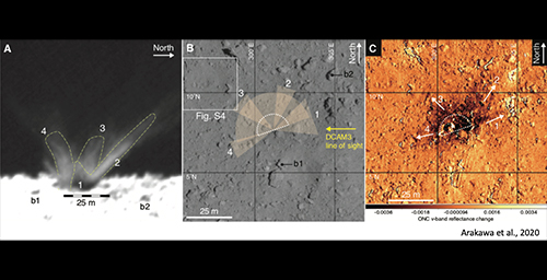
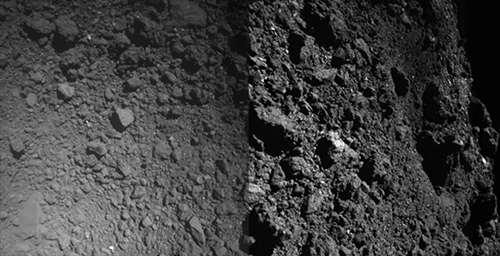
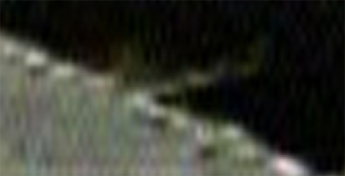
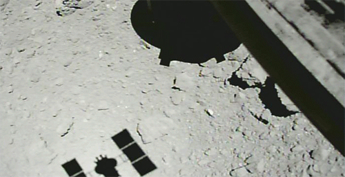
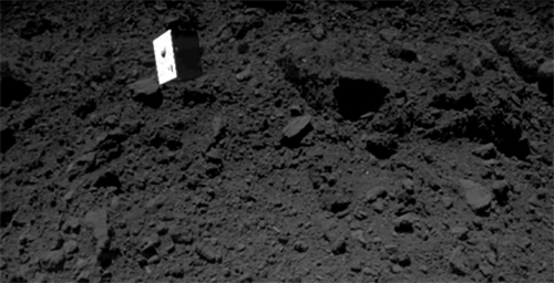
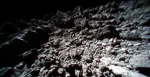
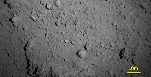
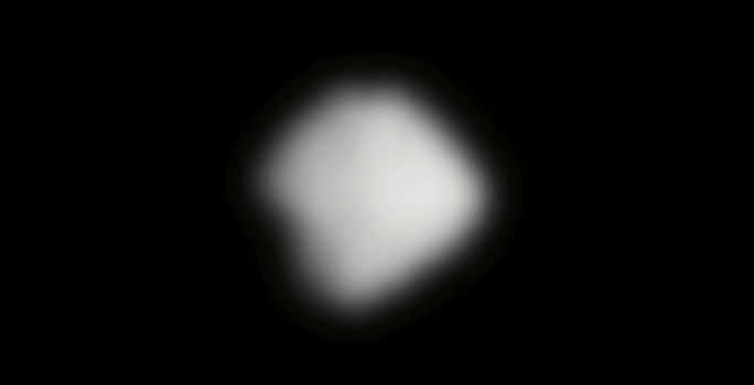
From February 20 to 22, we conducted the touchdown operation (TD1-L8E1) of Hayabusa2 on the surface of asteroid Ryugu. Figure 1 shows an image taken with the Optical Navigation Camera - Wide angle (ONC-W1) during the spacecraft ascent after touchdown.

[Open in a separate window. 512x512 pixels.]
[Open in a separate window(image where the overall brightness has been adjusted.)]
Figure 1: Image captured near the touchdown site immediately after touchdown. The photograph was taken with the Optical Navigation Camera - Wide angle (ONC-W1) on February 22, 2019 at an onboard time of around 07:30 JST.
(Image credit ※: JAXA, University of Tokyo, Kochi University, Rikkyo University, Nagoya University, Chiba Institute of Technology, Meiji University, University of Aizu, AIST.)
Figure 1 was captured roughly 1 minute after touchdown at an estimated altitude of about 25m (error is a few meter). The color of the region beneath the spacecraft's shadow differs from the surroundings and has been discolored by the touchdown. At the moment, the reason for the discoloration is unknown but it may be due to the grit that was blown upwards by the spacecraft thrusters or bullet (projectile).
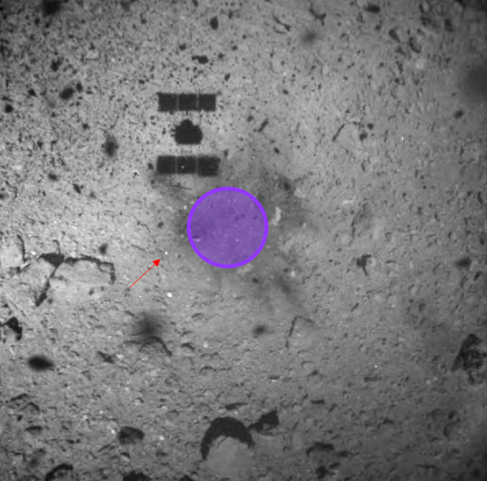
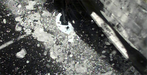
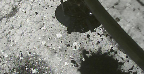
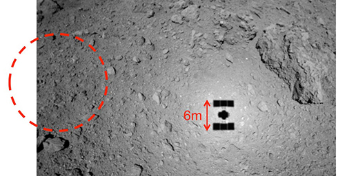
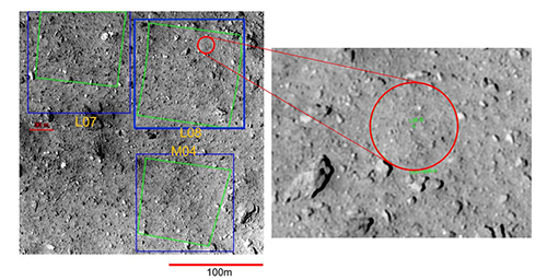
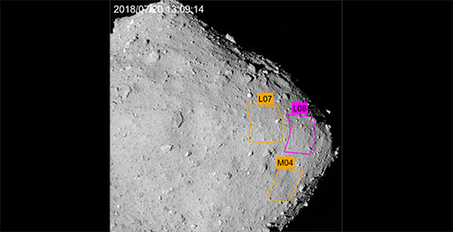
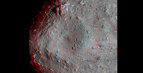
Figure 2 shows the same region as Figure 1 overlapped with the planned touchdown site. Since the touchdown site sits at the center of the discolored area, we believe that it was possible to touchdown at the expected place. However, an accurate touchdown point will be examined during a more detailed analysis in the future. Also shown in Figure 2 is the white target marker, which is shining in the reflected sunlight.
[Open in a separate window]
Figure 2: Touchdown image overlapped with the planned touchdown site. The white dot at the end of the arrow is the target marker.
(Image credit ※: JAXA, University of Tokyo, Kochi University, Rikkyo University, Nagoya University, Chiba Institute of Technology, Meiji University, University of Aizu, AIST.)
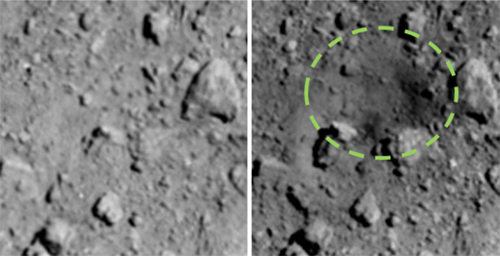
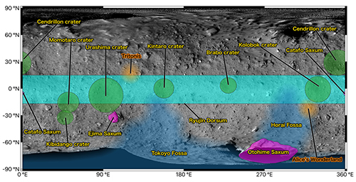
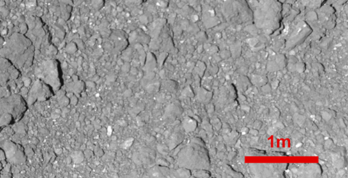
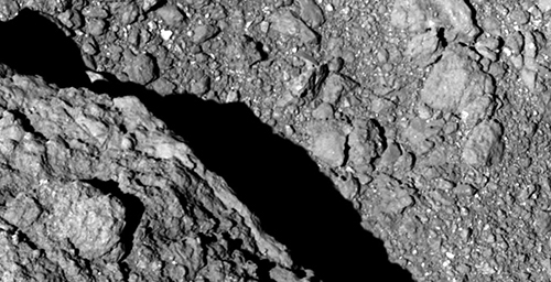
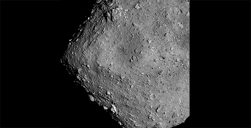
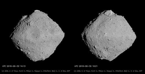
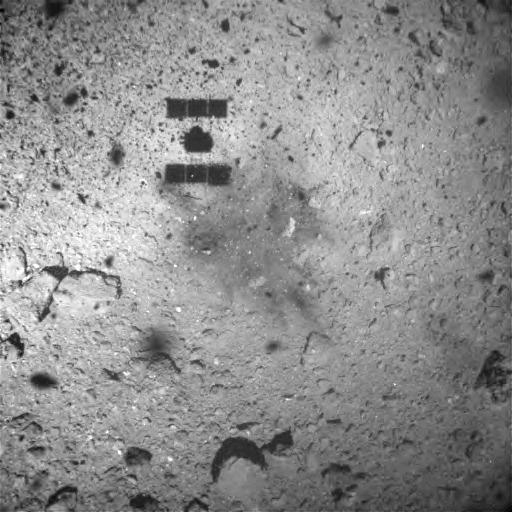
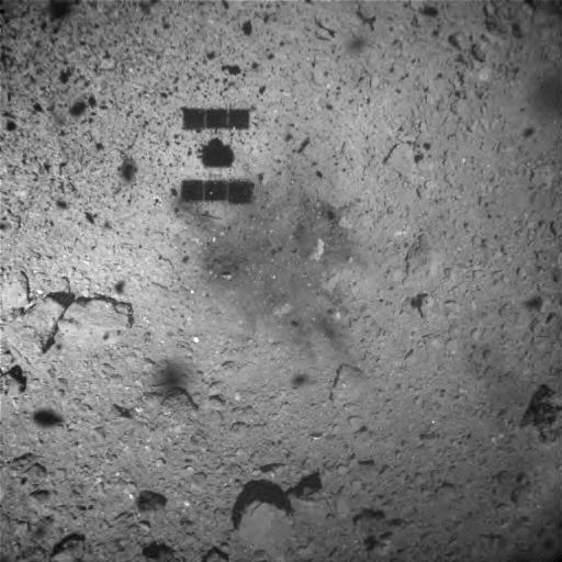
For comparison, Figure 3 shows the previously captured image of the touchdown site. Figure 4 shows this same image but without any markings. Since this image was taken before dropping the target marker, the target marker is not visible in this picture. As you can see from Figures 3 and 4, there was no discolored area on the asteroid surface around the touchdown point.

Figure 3: Position of the planned touchdown site and target marker. The size of the circle at the planned site is 6m in diameter. X indicates the position that the target marker was dropped at a later date.
(Image credit ※: JAXA, University of Tokyo, Kochi University, Rikkyo University, Nagoya University, Chiba Institute of Technology, Meiji University, University of Aizu, AIST.)
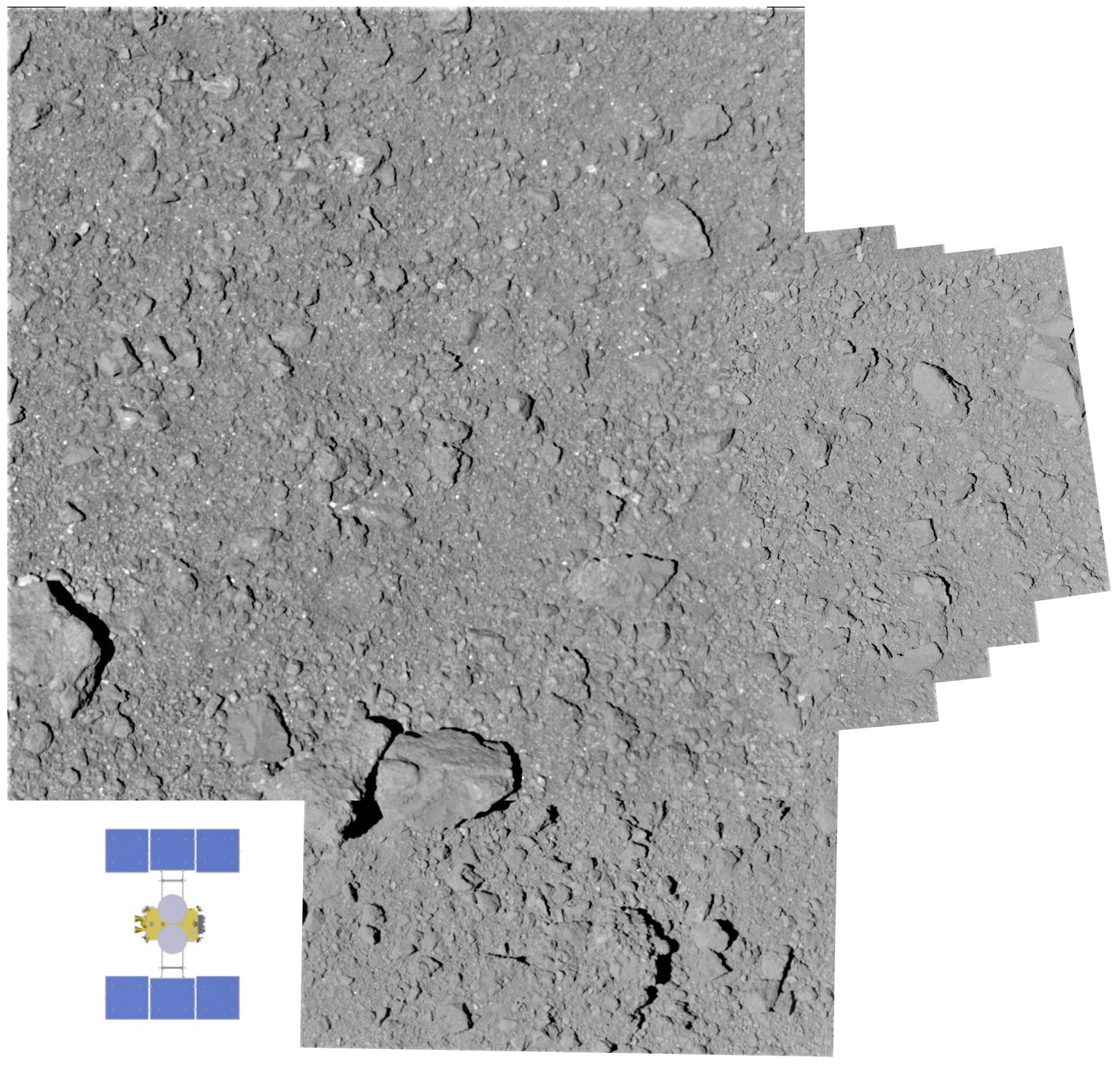
Figure 4: This is the same image as Figure 3, but without the markings.
(Image credit ※: JAXA, University of Tokyo, Kochi University, Rikkyo University, Nagoya University, Chiba Institute of Technology, Meiji University, University of Aizu, AIST.)
※ Please use the displayed credit when reproducing these images. In the case where an abbreviated form is necessary, please write "JAXA, University of Tokyo & collaborators".


