


TOP > Topics > 2004 > The earth pictured by Hayabusa
![]()
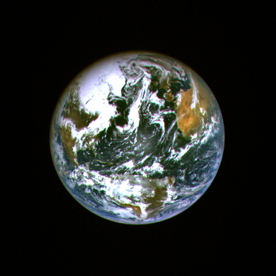
The earth pictured by Hayabusa
This earth image was acquired by Hayabusa at 10:00 p.m. on May 18 (Japan Standard Time). The distancebetween Hayabusa and the earth at that time was about 295,000 km. As Hayabusa came closer to the earth, the image became much clearer than the one taken on May 17. It shows the Atlantic Ocean in the center.
The right is the African and European Continents. You can see the north east area of the African Continent, the Iberian Peninsula, and part of the United Kingdom. The left side is the South and North American continents. In the lower left corner, you can clearly see the north east area of the South American Continent. The central America area is covered by clouds, but you can see from Mexico to the central area of the United States, and Cuba.
The image was taken by the onboard Asteroid Multiband Imaging Camera (AMICA). It was composed of three individually filtered images
© 2004 JAXA.
|

- open new windowWeb Data Citation Policy
May 19, 2004