


TOP > Topics > 2008 > KAGUYA creates topographical map of the Moon 10 times more accurate than before
![]()
KAGUYA creates topographical map of the Moon 10 times more accurate than before
Using the Laser Altimeter (LALT) aboard the Lunar Explorer KAGUYA, JAXA acquired data covering the entire Moons surface and produced a topographical map of the Moon in cooperation with the National astronomical Observatory of Japan and the Geographical Survey Institute.
The LALT aboard the KAGUYA acquired the altitude data on the entire Moon, including the polar regions (above longitude 75 degrees), where other Lunar explorations had never investigated before. The number of measurement points is over 6 million (as of end of March, 2008), which exceeds 1 digit more than that of the former model Unified Lunar Control Network 2005 (ULCN 2005). From now on, the density of measurement points will increase through continued observations and a topographical map with even greater accuracy is anticipated.
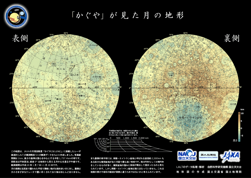
The LALT aboard the KAGUYA
[ Click image for enlargement ]
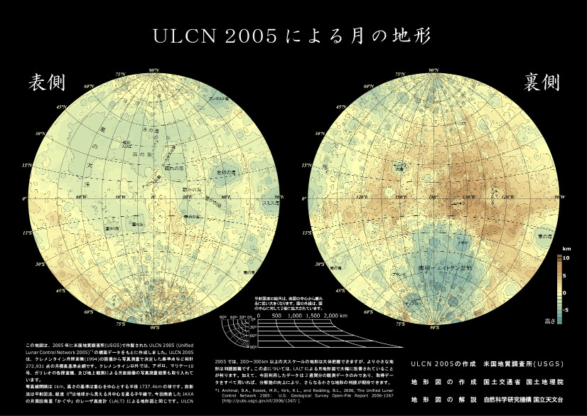
Lunar Control Network 2005 (ULCN 2005)
[ Click image for enlargement ]
April 14, 2008